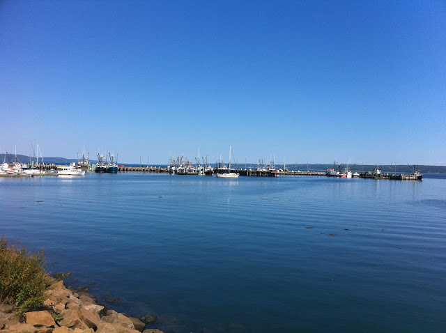
So first a picture of Digby on a nice warm day. The fleet here catch lobster and scallops mostly. You can enjoy them in many fine local eateries. I recommend the "SHORE LINE" it has great food.
Here is the route I took as mapped by my GPS.
 |
| Digby to Delap's Cove and back. |
So now off to Annapolis Royal. It is an old town with a lot of history. You can find quaint little shops and stores and there is a farmers market with local produce in the summer.
The town was the capital of Acadia and later Nova Scotia for almost 150 years, until the founding of Halifax in 1749. It was attacked by the British six times before permanently changing hands after the Conquest of Acadia in 1710. Over the next fifty years, the French and their allies made six unsuccessful military attempts to regain the capital.
Including a raid during the American Revolution, Annapolis Royal faced a total of thirteen attacks, more than any other place in North America.
This is Fort Anne. The grounds are lovely and worth a walk as is the old graveyard that has stones from the 1700's. That's pretty cool.
Here is the Fort from across the berms.
Now I left Annapolis and went across to Granville Ferry and towards Port Royal.
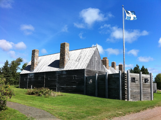
It's a great place to explore and see the old fort with it's very short doorways! Watch your head.
From there past the lighthouse on the Granville Rd with a nice view of the beach.
The next stop was in Victoria Beach to have a quick look around at the wharf and boats.
It was very quiet and I don't think I saw one other person while I was there. Kind of neat. The road is quite narrow and there is a turn up towards a light house ( I didn't get a pic, I don't know why) that is very sharp and steep. When you look at it you really think that you don't want to stop there as it will be such a pain to get going again!!
Then through the rest of Victoria beach and on towards Delap's Cove. The pavement ends and there is a sign that says rough road ahead. It wasn't lying. Most is good hard gravel but some is hard bedrock and then strewn with rocks and gravel and some large rocks thrown in for good measure. Also closer to Delap's Cove there was a section almost washed out by the small creek. A vehicle wouldn't have made it but the KLR was fine and zipped by.
I finally came out to the parking spot in Delap's Cove.
This is some of the trail.
That's pretty much it. It was a fun ride and took about 2 hrs and 45 minutes if I remember correctly. Hopefully you can get down and do this ride one day.
Port Royal (known as Annapolis Royal) was once the capital of Acadia and is now a small rural community in the western part of the Canadian province of Nova Scotia. Initially Port Royal was located on the north shore of the Annapolis Basin, Nova Scotia, where there is currently the reconstruction of the original Habitation at Port-Royal. After its destruction (1613), Port Royal was re-established on the south shore of the basin. The British renamed the settlement Annapolis Royal after their conquest of Acadia (1710).
Port Royal was founded by Pierre Dugua, Sieur de Mons and Samuel de Champlain in 1605. The village was the first permanent European settlement north of St. Augustine, Florida. (Two years later, the English made their first permanent settlement in Jamestown, Virginia.) Approximately seventy-five years after Port Royal was founded, Acadians migrated from the capital and established what would become the other major Acadian settlements before the Expulsion of the Acadians: Grand Pré, Chignecto, Cobequid and Pisiguit.
Prior to the founding of Halifax (1749), Port Royal/ Annapolis Royal was the capital of Acadia and later Nova Scotia for most of the previous 150 years.[1] During that time the British made six attempts to conquer Acadia by defeating the capital. They finally defeated the French in the Siege of Port Royal (1710). Over the following fifty years, the French and their allies made six unsuccessful military attempts to regain the capital.
 |
| Port Royal Fort |
From there past the lighthouse on the Granville Rd with a nice view of the beach.
The next stop was in Victoria Beach to have a quick look around at the wharf and boats.
 |
| Looking towards the wharf. |
 |
| The wharf itself with the entrance on the right. |
 |
| The inner area protected by the wharf itself. Some fish shacks in the back. |
 |
| An old fish processing plant. |
It was very quiet and I don't think I saw one other person while I was there. Kind of neat. The road is quite narrow and there is a turn up towards a light house ( I didn't get a pic, I don't know why) that is very sharp and steep. When you look at it you really think that you don't want to stop there as it will be such a pain to get going again!!
Then through the rest of Victoria beach and on towards Delap's Cove. The pavement ends and there is a sign that says rough road ahead. It wasn't lying. Most is good hard gravel but some is hard bedrock and then strewn with rocks and gravel and some large rocks thrown in for good measure. Also closer to Delap's Cove there was a section almost washed out by the small creek. A vehicle wouldn't have made it but the KLR was fine and zipped by.
I finally came out to the parking spot in Delap's Cove.
This is some of the trail.
 |
| Easy riding here. |
 |
| The parking area for the trail into the waterfall. I missed the waterfall. |
That's pretty much it. It was a fun ride and took about 2 hrs and 45 minutes if I remember correctly. Hopefully you can get down and do this ride one day.


No comments:
Post a Comment