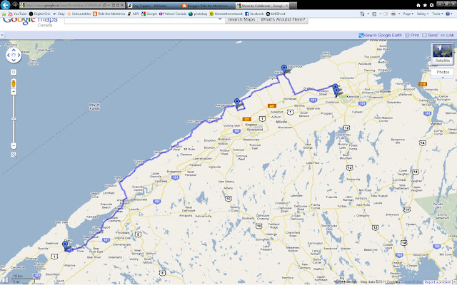
Once I crossed over at Annapolis Royal via the Parkers Cove road, I rode along the shore as much as I could.
This was taken around Saint Croix Cove I think. I didn't take it with my iPhone that tags the pics with GPS. It has an OK 5 MP cam but my G9 is a way better photography tool and has a zoom. So I used that today. Downside...sometimes I can't remember where I took a photo!!!
From there off down the shore again to Mount Hanley and Port George.
This old school house is now a museum. It wasn't open when I was going by, but next time I will stop in!!
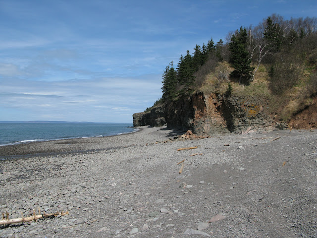
This is a picture of the shoreline along Port George. It is very rugged and consists mostly of rough rocks and stone along the water. It has a picnic spot and some outhouses though if the need is a calling.
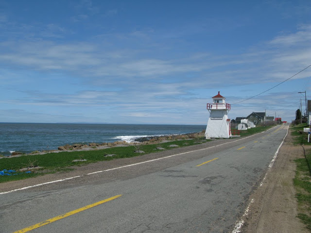
The highway along Port George is small but not well travelled and I had the road mostly to myself the whole ride. It's neat being so close to the shore and riding along on a paved highway.
A close up of the lighthouse.
The first lighthouse in Port George, Nova Scotia was in the 1880's that guided water vessels to safety and was one that was simple as a light was attached to a pole. In 1889, the first real lighthouse was erected on the Port George wharf but the lighthouse keeper would have to light the kerosene lantern every night and return in the early morning to blow it out.
The wharf began to deteriorate...around the 1930's and the Port George lighthouse was then moved up to the roadside location where it stands today. The only difference being is that electricity was finally available in the town of Port George, Nova Scotia in Canada and instead of a kerosene lantern, there is sensor electric bulb. This is a reliable source that makes the light from the Port George lighthouse shine everyday around dusk until the early morning hours.Recent updates have been made to the lighthouse and it is still a main point of interest for the community of Port George, Nova Scotia in Canada. The lighthouse itself stands at twenty-five high, but it is thirty-one feet above the water's edge adorned in the typical red and white lighthouse colors.
This is the lighthouse in Margaretsville. It is also a nice little spot and has tourists going through during the summer. A bit of info on Margaretsville.....
From Wikipedia, the free encyclopedia
Located on the Bay of Fundy, Margaretsville was named for Margaret Inglis by her husband the Honourable Brenton Halliburton, 8th Chief Justice of Nova Scotia. Margaret was the daughter of Bishop Inglis, the first Anglican Bishop of Nova Scotia. When they married her father gave them an estate on the shore which included all the area around where present day Margaretsville sets. This estate sat next to Sir Brenton's father's estate. The Halliburtons had built their summer home in the area in 1802.
Over the years there have been approx. 15 general stores in and around the community of which none now exist. During World War I, Margaretsville had the distinction of setting a record in Nova Scotia by having over 10% of its population enlist for military service and being second in all of Canada[citation needed].
In 1946, Margaretsville was honored by having a lady in the community with the longest name in Canada: Mrs. Harriett Belle Franklyn Laura Victoria Adeline Drake Gibson.
In a local newspaper dated May 1901, it was stated that a building was sold, in which Mr. Moody of Margaretsville, built the sailing ship Spray in which Capt. Joshua Slocum made his famous solo voyage around the world.
A busy port during the early 1900s, Margaretsville is now a placid seaside community favored by tourists, artists and retirees. There is a small local art gallery and lively folk music scene.
Many locals refer to village as 'Margaretville' (without an 's') and local road signs are inconsistent in their spelling of the name. However the present name is in fact Margaretsville, with the "S", as the Nova Scotia Geographical Names Database changed the name from "Margaretville" to "Margaretsville" on April 5, 1951.
An interesting piece of information concerning Margaretsville is the lighthouse which some say appears on the 1967, 5 cent Canadian stamp. As all lighthouses are unique the picture on the stamp matches very closely the Margaretsville lighthouse.
This a view of the road by the lighthouse. Very quiet and quaint.
Along the back roads again. There has been a lot of rain this year and you never know what you might find out on these seldom travelled back roads. I came along this nice puddle that was about 10 meters across. It looked mostly shallow and easy so off I went. This looking back after I went through.
Also came along this sign that all ADV riders of course love to see!!!!
Once back on the road a few twists and turns and some dirt will bring you to Morden. It is another little village that sits quietly along the Bay shore.
The zeolite mineral Mordenite was named for the town of Morden when Henry How discovered it in 1864.
This is the view of the cross with the picnic area and the Bay of Fundy in the background.
This is the beach in Morden.
After I left Morden I drove along the back roads to Victoria Harbour. I always thought there was something to see in Victoria Harbour. Well I was wrong, there is really nothing there!! The rough road leads down to the beach and there is a small cottage there, but nothing else really. There is only about 50 meters of beach as well between high cliff formations.
 |
| Victoria Harbour |


I did this section of the coast about a month ago. Wanted to go to Halls Harbour.. but didn't have detailed maps and gave up at Harbourville.. mby next time. 221 back to Annapolis Royal along the edge of the North Mtn.. is an awesome ride.
ReplyDeleteYes it's a nice route. That's too bad you stopped Rob, it's only a short hop to Halls Harbour from Harbourville.
ReplyDeleteMaybe see you on the road one day!
Andrew